© 2025 大分市デジタルアーカイブ
© 2025 大分市デジタルアーカイブ
 Loading...
 Loading...

「大分を語るうえで欠かせないものごと(essentials)」を、ぎゅっと詰め込みました。大分に来たことのない方や海外の方にとって、このWebサイトが、数ある日本の地域のなかで“大分とはどんな場所か”を知る入り口となれば、うれしく思います。
地元で暮らしている方や、大分を知っている方にとっては、一度は耳にしたことのあるような、身近な場所も多いかもしれませんが、あらためて見つめ直してみると、ふと新しい表情が立ち現れることがあります。そんな小さな驚きや新たな気づきをお届けできたらと思っています。
実際に訪れて感じる大分の魅力のひとつは、観光地として知られる場所であっても、日々の暮らしの延長にある風景や、そこに息づく人々の営みが、静かに輝いていることです。その日、その時間にしか出会えない光や風、人との会話——そんな偶然の重なりが、訪れる人と大分とのつながりを、より深く、より特別なものにしてくれるのではないでしょうか。
ここでご紹介しているのは、大分のほんの一部です。それぞれの「essentials」に込められた物語を手がかりに、これを手にした方々が自分だけの「大分の楽しみ方」を見つけて、大分を好きになっていただけることを願っています。
097-506-2112
097-506-1729
a14180@pref.oita.lg.jp
This book is packed full of ‘essentials’, that are indispensable when talking about Oita. We hope this guide is a gateway for those unfamiliar with Oita, whether from Japan or abroad, offering insight into what Oita is really like among the many regions of Japan.
For locals or those acquainted with Oita, many of the places in the book may be familiar. However, by looking at them again with fresh eyes, you may discover new aspects and find yourself pleasantly surprised. We compiled this guide hoping to bring you moments of rediscovery and delightful new insights.
One of the charms of Oita, we feel, is that even in well-known tourist spots, the scenery reflects everyday life. The local inhabitants who live and breathe there, shine quietly, with their culture and daily activities becoming a natural extension of this scenery. The light and gentle breeze felt only on that day and at that moment, along with the conversations exchanged with locals or fellow visitors, forge, and build upon, a deeper and more meaningful connection between visitors and Oita.
The book contains only a slice of what Oita has to offer. We hope that the narratives behind each of the essentials featured will inspire readers to discover their own ways of appreciating and exploring Oita, developing a love for the region.
097-506-2112
097-506-1729
a14180@pref.oita.lg.jp
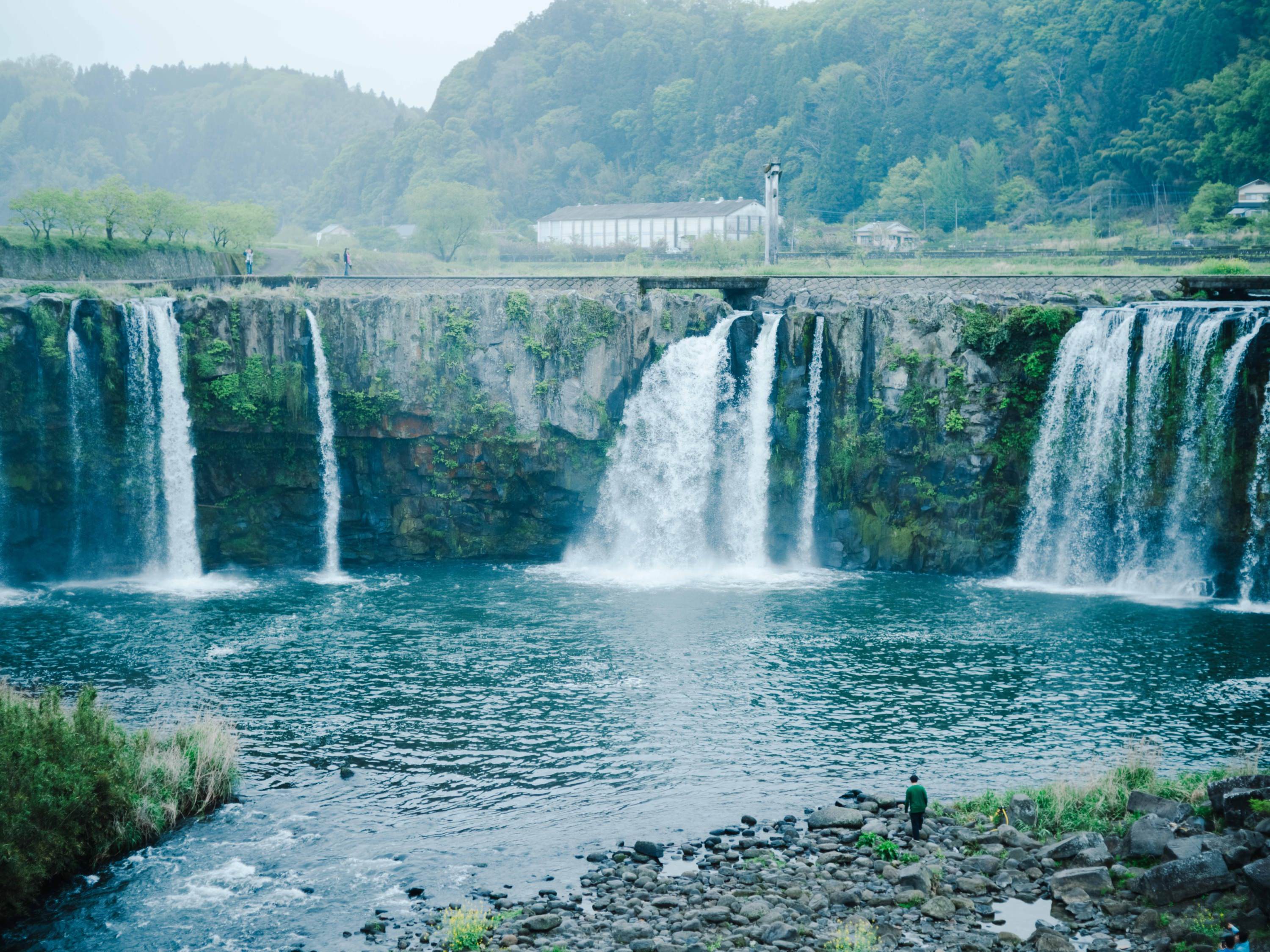
大分県南部の豊後大野市は、県内最大の河川・大野川が市の中央を流れ、周囲をくじゅう連山、阿蘇山、祖母・傾山系の山々に囲まれた、緑豊かな土地です。「おおいた豊後大野ジオパーク」として、市の全域が日本ジオパークに認定されています。
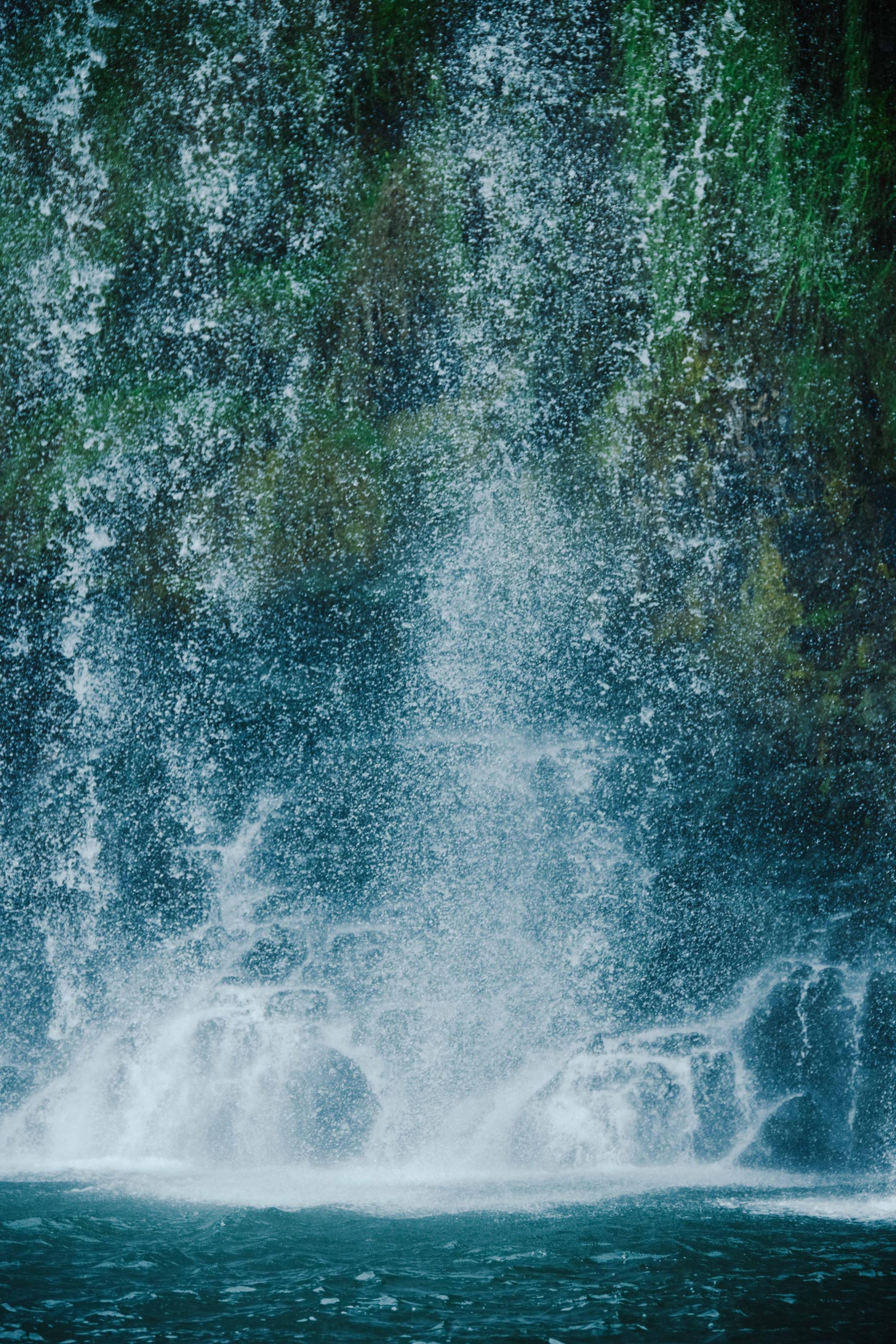
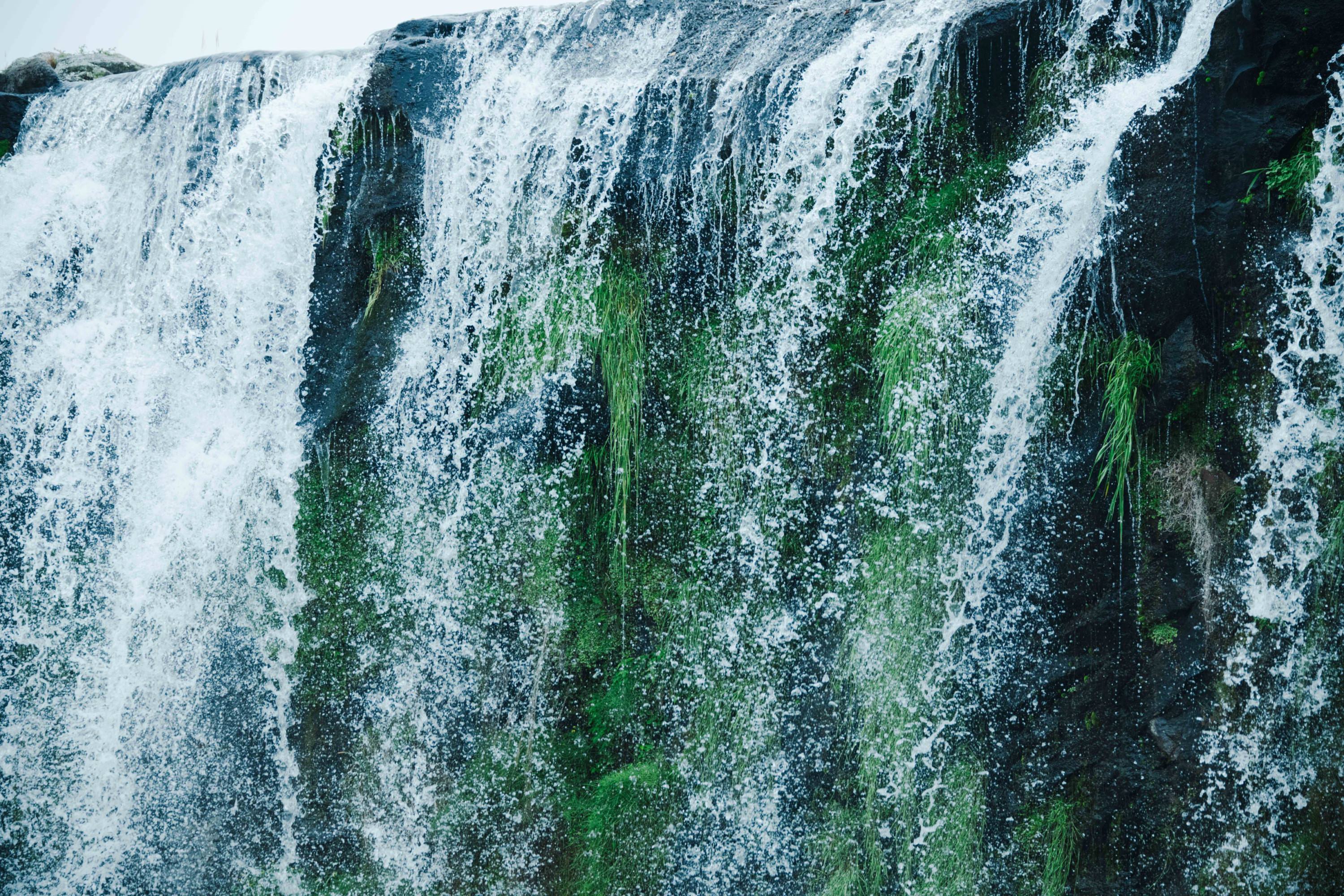
その田園地帯を車で進むと、突如として壮大な滝が姿を現します。これが「原尻の滝」。幅約120m、高さ約20mを誇り、「東洋のナイアガラ」とも呼ばれる名瀑です。約9万年前の阿蘇火山の巨大噴火によって堆積した火砕流が冷え固まり、長い年月をかけて川の流れに削られたことで形成されました。
滝の周囲には遊歩道が整備されており、吊り橋「滝見橋」からは滝を正面から望めます。上流には沈下橋(増水時に水面下に沈むように設計された橋)も架けられており、滝の上部を車や徒歩で渡ることも可能です。これらの橋を通って滝のまわりを一周すれば、さまざまな角度からその雄大な姿を楽しめます。
Bungo–Ono City in Southern Oita Prefecture is characterised by its lush greenery, and is surrounded by the Kuju mountain range (Mount Aso, Mount Sobo and Mount Katamuki), with the Ono River, the largest in the prefecture, flowing through its centre. The entire city is certified as a Japanese National Geopark, known as ‘Oita Bungoono Geopark’.
As you drive through the countryside, a spectacular waterfall will suddenly catch your eye. This is the famous Harajiri Falls, which is 120 m wide and 20 m high, and is often referred to as the ‘Niagara of the East’. The waterfall was formed when pyroclastic flows from a massive eruption from the Aso Volcano about 90,000 years ago cooled and solidified, before being gradually eroded away by the river flow over a long period of time.
There is a promenade around the falls, and the suspension bridge ‘Takimi Bridge’ offers a direct view of the falls. An adjustable bridge that submerges when water levels rise was also built upstream, enabling visitors to cross the upper part of the falls by car or on foot. Circling the falls via these bridges, visitors can appreciate the marvellous scenery from various viewpoints.